

Picture-Map app for iPhone and iPad
Developer: Sylver Bruneau
First release : 12 Jul 2011
App size: 2.38 Mb
Are you missing the picture on map feature ? Picture Map is for you !
Picture Map is presenting your iPhone camera roll content in a new and exciting way!
With PictureMap, you will no longer ask yourself "what place is on this picture?"
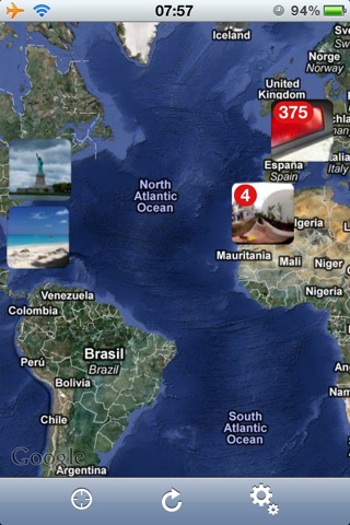
Pictures containing GPS informations will be shown on the world map, youll see in a second all the places you traveled in. Its a nice way to remind all the places you did visit during your holidays !
Features:
- Shows thumbnails of your pictures on the world map
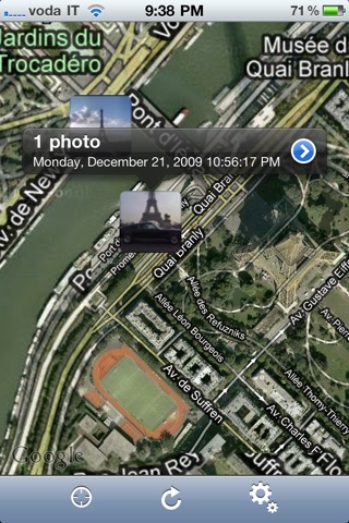
- Tap a thumbnail to see details and button to show full screen pictures
- Pictures at the same location are grouped into a thumbnail
- Zoom on the map to view where exactly the picture was taken
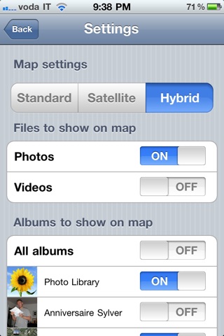
- Change map type (map, satellite or hybrid)
- Zoom to users current location
- You can select the albums to show on the map
- You can make the thumbnails transparent
- You can emails photos with a web link to a map showing the location of the photo
Notes:
- Require a device with location capability (cell location / GPS)
- Allow the camera application to access users location or pictures will not include location data
- Some picture may appear not exactly where they were taken depending on location accuracy (indoor pictures will have less accuracy than outdoor pictures)
- Require at least OS 4.0
If you are using an iPad and the Camera Kit to import photos from your camera, photos with geolocation included will be shown on the map ! You can use the great iPhone app called gps4cam to add geolocation in the photos taken from your camera !